
Track every barge for a dollar a day.
Live positions, breakaway alerts in seconds, river conditions, charts and trip planning, all in one app built by people who have worked the river.
Install. Watch. Respond.
Rugged hardware on every asset, a cloud that never sleeps, and an app your crew opens without training.
Install the tracker
Bolt it on and connect power. It registers itself to your account.
Watch the fleet
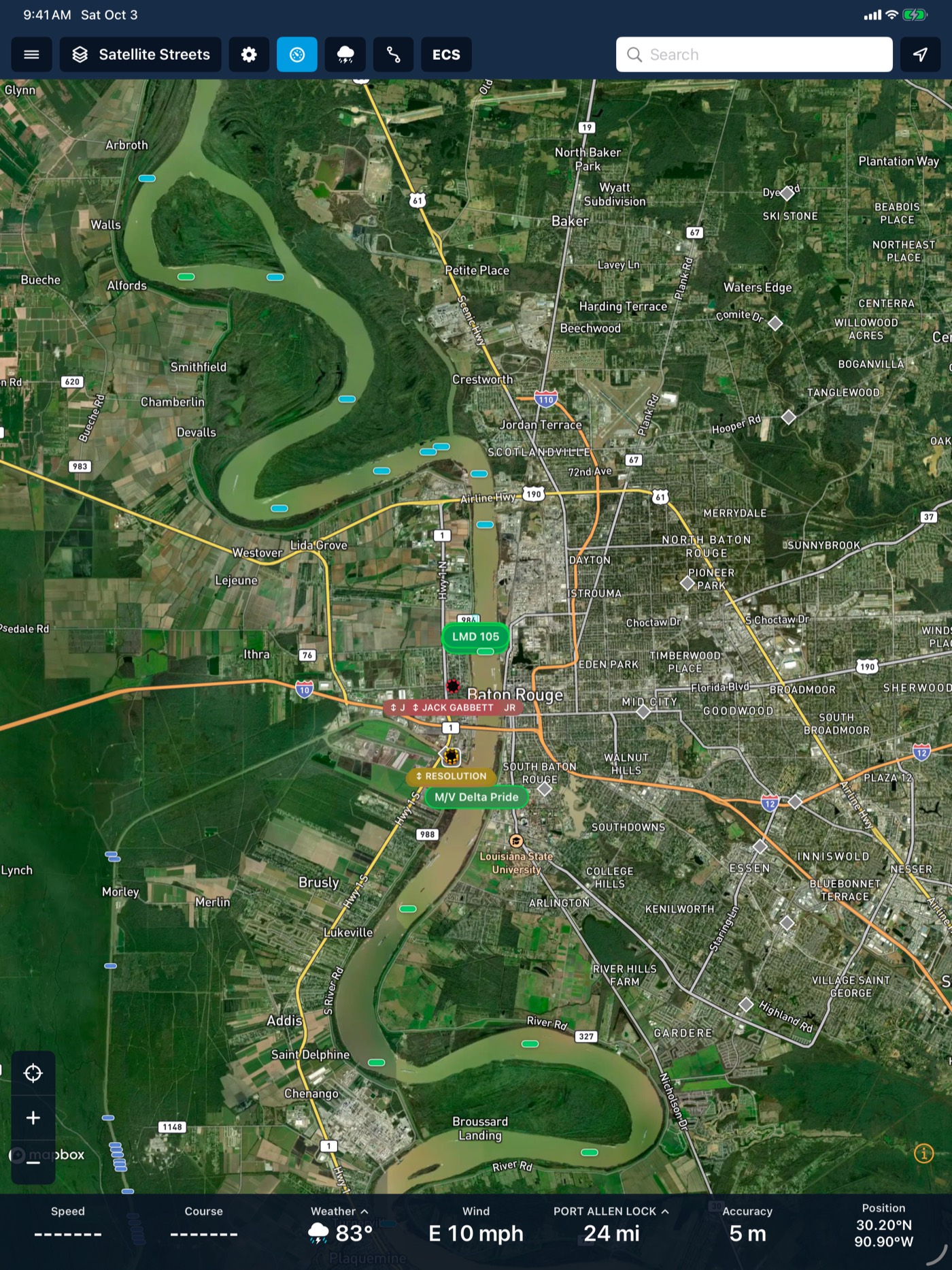
Every barge on one map with river conditions, AIS and charts.
Respond in seconds
Breakaways ring the right phones and show who can help.
A breakaway, start to finish
- 02:14:05Barge 104 left its stay-zone.
- 02:14:06Not a planned move. Going loud.
- 02:14:08Critical alert rings 4 phones, through silent mode.
- 02:14:20Nearby towboats shown for assist.
- 02:16:40A nearby towboat accepts and heads upriver.
- 02:31:10Barge 104 back in the fleet. Debrief saved.
The same fleet on every screen
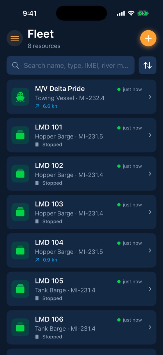
Crews carry it on their phones and captains run it on the wheelhouse iPad.
- Same login and permissions everywhere
- Charts and river bottom work offline
- Critical breakaway alerts ring through silent mode
Twelve things your crew will use every day
Live fleet map
Every barge reports its position once a minute as standard, and as often as every 2 seconds when you need it.
Learn more →Breakaway response
Draw a stay-zone around each barge.
Learn more →Geofences & fleeting zones
Outline fleeting areas, docks and terminals on a satellite map or import them from a spreadsheet.
Learn more →Alerts
Each alert has its own rules for who hears it and how loud, and each person decides which of their phones and iPads ring.
Learn more →Sensors & alarms
Connect the engine network and sensors you already have to a FleetIQ Pro.
Learn more →River conditions
Live USGS gauges, NOAA river-current forecasts for 34,912 river reaches, USACE lock queues and stoppages, and weather radar, all on the map your crew already uses.
Learn more →AIS & watched vessels
Every BargeIQ tracker on the water listens for AIS and relays what it hears, so you see the tows around your fleet, and you can get a push when a particular boat reaches your zone.
Learn more →Charts
Inland ENCs from the Corps of Engineers and NOAA ENCs for the coast, rendered the way you are used to seeing them.
Learn more →Bridge clearance
BargeIQ shows the vertical clearance at every bridge, kept current with live river levels, and warns you when your tow's air draft will not fit.
Learn more →Trip planner
Plan routes across the inland rivers and the Gulf Intracoastal.
Learn more →Teams & permissions
Crew, captains, dispatchers, port engineers, managers and admins each get the access their job needs.
Learn more →Rugged trackers that keep reporting.
FleetIQ tracks every barge on the river. FleetIQ Pro adds engine data, sensors and Subchapter M alarms for towboats and tank barges. Both are sealed, rated for hazardous locations and store 60+ days of data on board.
 FleetIQ Pro
10–28 V
6.9 × 4.6 × 2.1 in. Drag to turn.
See your fleet the way it should be seen.
Book a 20-minute demo with someone who has worked the river.