
Gauges, currents, locks and weather, without opening six websites.
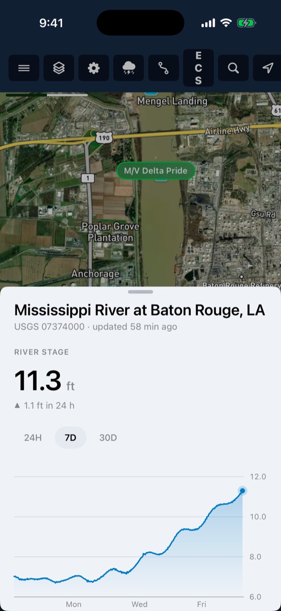
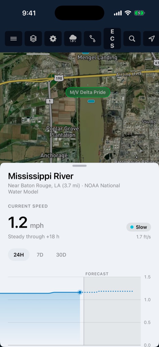
Live USGS gauges, NOAA river-current forecasts for 34,912 river reaches, USACE lock queues and stoppages, and weather radar, all on the map your crew already uses.
From the first signal to the last step
Gauges
Stage, flow and flood categories for every USGS gauge on the system, with the 30-day trend.
Currents
NOAA National Water Model velocity and streamflow for each reach, with a 10-day forecast.
Locks
Queue length, expected and typical wait, stoppages and lock water levels.
Weather
Radar overlay on the same map as your fleet.
Included with every account
- USGS Water Data API gauges
- NOAA NWM currents, 10-day forecast
- USACE lock status and closures
- Radar overlay
- Tap any marker for the full chart
Crews see rising water and lock queues before they commit a tow.
Works with
Trip planner
Plan routes across the inland rivers and the Gulf Intracoastal.
Learn more →Charts
Inland ENCs from the Corps of Engineers and NOAA ENCs for the coast, rendered the way you are used to seeing them.
Learn more →Bridge clearance
BargeIQ shows the vertical clearance at every bridge, kept current with live river levels, and warns you when your tow's air draft will not fit.
Learn more →See your fleet the way it should be seen.
Book a 20-minute demo with someone who has worked the river.