
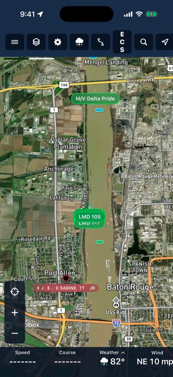
Every barge, on one map, right now.
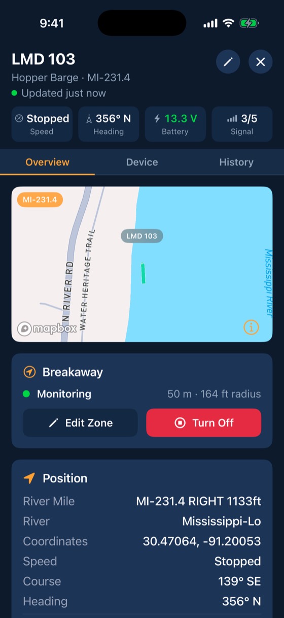
Every barge reports its position once a minute as standard, and as often as every 2 seconds when you need it. Each one shows its river mile, speed, heading and time of last report, so nobody has to call the fleet boat to ask where something is.
What your crew sees
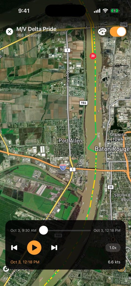
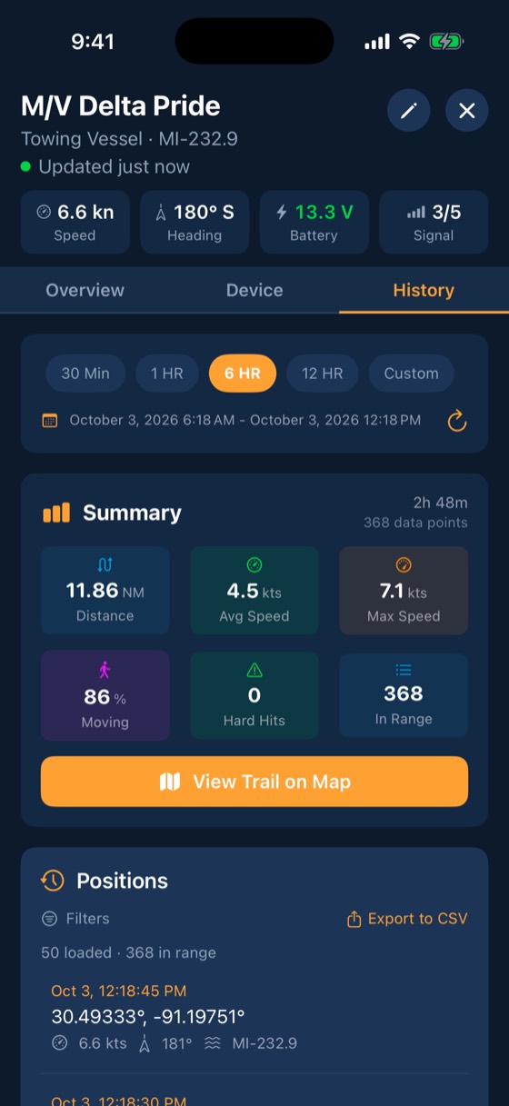
Three steps
Trackers report
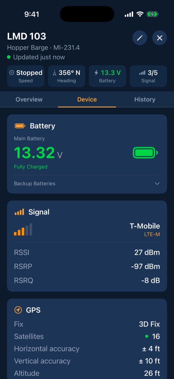
Each tracker sends a position on the cadence you choose, every 2 to 60 seconds (once a minute is standard), plus a health heartbeat every 60 seconds.
The cloud adds the river mile
Every position is matched to the U.S. Army Corps of Engineers channel mile markers, so each barge shows its river, mile and bank side, like Lower Miss mile 229.4. Everyone reads the same location.
Your crew sees it
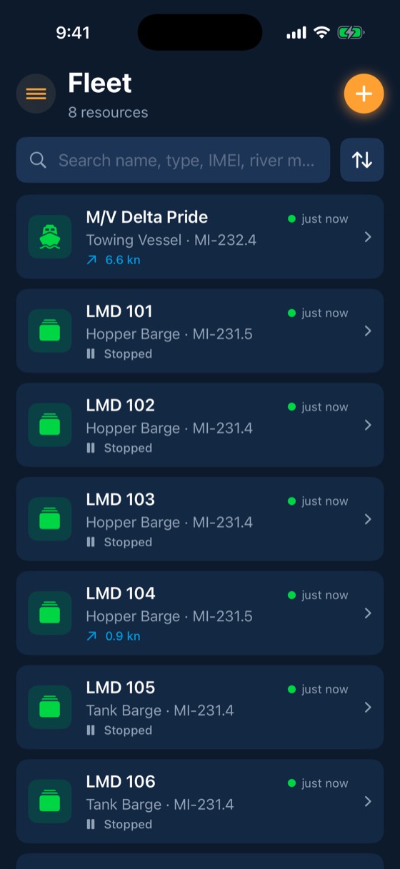
The map, the fleet list and the barge page all update live on iPhone, iPad and the web.
Included with every account
- River mile and bank side on every fix
- History playback
- Captain on Duty shows who has the watch
- Voyage log built from the track automatically
- Works with weak signal: trackers store at least 60 days of data on board and backfill
Dispatch and fleeting crews stop driving the bank to count barges. Most fleets spend several crew-hours a week on manual checks.
Common questions
How often does the position update?
You pick per tracker, from every 2 seconds to once a minute. Most fleets run once a minute.
What happens without cell signal?
The tracker stores fixes on board and sends them when it reconnects. Where there is no cell signal at all, FleetIQ Pro can report over long-range Wi-Fi HaLow to a StationIQ base station.
Works with
Breakaway response
Draw a stay-zone around each barge.
Learn more →Geofences & fleeting zones
Outline fleeting areas, docks and terminals on a satellite map or import them from a spreadsheet.
Learn more →Teams & permissions
Crew, captains, dispatchers, port engineers, managers and admins each get the access their job needs.
Learn more →See your fleet the way it should be seen.
Book a 20-minute demo with someone who has worked the river.