
Know your air gap at every bridge, before you get there.
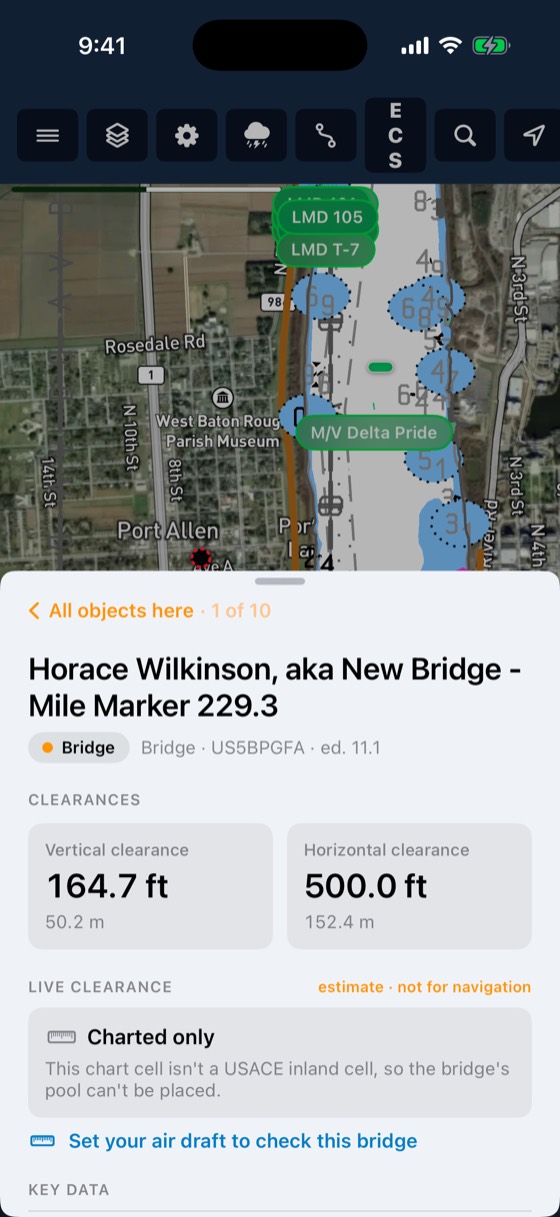
BargeIQ shows the vertical clearance at every bridge, kept current with live river levels, and warns you when your tow's air draft will not fit.
Three steps
Every bridge
Every charted bridge on the inland system is covered.
Live river levels
Clearance updates as the river rises and falls.
Your tow
Set your air draft once per boat. Every bridge on the route shows pass or no-pass.
Included with every account
- Every charted bridge on the inland system
- Live clearance in feet
- Pass or no-pass for your air draft
- Shown on the map and in the trip plan
Clearance is checked before the tow leaves, not at the bridge.
Common questions
How accurate is it?
Clearance comes from official bridge data and live river levels, and the captain always has the final say.
Which bridges are covered?
Every charted bridge on the inland river system, fixed and movable.
How often does clearance update?
Whenever new river level readings come in, usually several times an hour.
Where do I enter my air draft?
Once per boat in the app. Change it any time the tow changes, and every bridge updates.
Does it show on my trip plan?
Yes. Every bridge on the route shows pass or no-pass before the tow leaves.
Works with
Trip planner
Plan routes across the inland rivers and the Gulf Intracoastal.
Learn more →Charts
Inland ENCs from the Corps of Engineers and NOAA ENCs for the coast, rendered the way you are used to seeing them.
Learn more →River conditions
Live USGS gauges, NOAA river-current forecasts for 34,912 river reaches, USACE lock queues and stoppages, and weather radar, all on the map your crew already uses.
Learn more →See your fleet the way it should be seen.
Book a 20-minute demo with someone who has worked the river.